Checked
Nature trails and natural areas in London
London, Ontario, Canada
London natural area maps, Sifton Bog boardwalk, Kains Woods and The Coves trail details, managed ESA locations, cycling rules and access planning.

Key information
London has 21 designated Environmentally Significant Areas, called ESAs, and UTRCA manages 12 of them for the City. Use the managed-area maps and marked public entrances. Natural area trails have different surfaces and rules from the paved Thames Valley Parkway. Some designated land is privately owned.
On this page
Natural area trails and the Thames Valley Parkway
| Place | Main distinction | Source to use |
|---|---|---|
| Thames Valley Parkway | Paved shared-use network with construction and detour notices | City TVP map |
| Managed ESA trail | Marked walking trail or specifically permitted multi-use path | UTRCA area map and entrance signs |
| Other designated ESA land | Designation can include private property | Official ownership and access information |
| Park path | Recorded infrastructure may not describe a complete visitor route | City park record and actual entrance |
- City Thames Valley Parkway maps and construction
- UTRCA managed natural areas, maps and issue reporting
- Full parks and open spaces directory
Sources: City Thames Valley Parkway maps and construction · City natural area access and trail rules · UTRCA managed natural areas, maps and issue reporting · City parks inventory
All 12 UTRCA-managed London ESAs
Quick comparison and full source records
| Natural area | Published visitor material |
|---|---|
| Byron Valley | Map |
| The Coves | Brochure and map |
| Kains Woods | Brochure and map |
| Kelly Stanton | Map |
| Kilally Meadows | Brochure and map |
| Lower Dingman | Brochure and map |
| Meadowlily Woods | Brochure and map |
| Medway Valley Heritage Forest | Brochure and map |
| Pottersburg Valley | Map |
| Sifton Bog | Brochure and map |
| Warbler Woods | Brochure and map |
| Westminster Ponds / Pond Mills | Brochure and map |
Use the area name in UTRCA’s linked directory to get the current map. The 12 managed areas are not the same as all 21 designated ESAs or the number of separate land records in the City inventory.
Byron Valley
211 Halls Mill Rd
Byron Valley: Map.
- Published visitor material
- Map
This pin shows one City land record within the natural area. It is not a trailhead. Use the linked UTRCA visitor map for signed entrances, routes and access restrictions.
Sources: UTRCA managed natural areas, maps and issue reporting · City parks inventory and location data · City open data terms
The Coves
18 Elmwood Ave W
The Coves: Brochure and map.
- Published visitor material
- Brochure and map
This pin shows one City land record within the natural area. It is not a trailhead. Use the linked UTRCA visitor map for signed entrances, routes and access restrictions.
Sources: UTRCA managed natural areas, maps and issue reporting · City parks inventory and location data · City open data terms
Kains Woods
1511 Shore Rd
Kains Woods: Brochure and map.
- Published visitor material
- Brochure and map
This pin shows one City land record within the natural area. It is not a trailhead. Use the linked UTRCA visitor map for signed entrances, routes and access restrictions.
Sources: UTRCA managed natural areas, maps and issue reporting · City parks inventory and location data · City open data terms
Kelly Stanton
1170 Hyde Park Rd
Kelly Stanton: Map.
- Published visitor material
- Map
This pin shows one City land record within the natural area. It is not a trailhead. Use the linked UTRCA visitor map for signed entrances, routes and access restrictions.
Sources: UTRCA managed natural areas, maps and issue reporting · City parks inventory and location data · City open data terms
Kilally Meadows
868 Windermere Rd
Kilally Meadows: Brochure and map.
- Published visitor material
- Brochure and map
This pin shows one City land record within the natural area. It is not a trailhead. Use the linked UTRCA visitor map for signed entrances, routes and access restrictions.
Sources: UTRCA managed natural areas, maps and issue reporting · City parks inventory and location data · City open data terms
Lower Dingman
3370 Homewood Lane
Lower Dingman: Brochure and map.
- Published visitor material
- Brochure and map
This pin shows one City land record within the natural area. It is not a trailhead. Use the linked UTRCA visitor map for signed entrances, routes and access restrictions.
Sources: UTRCA managed natural areas, maps and issue reporting · City parks inventory and location data · City open data terms
Meadowlily Woods
120 Meadowlily Rd S
Meadowlily Woods: Brochure and map.
- Published visitor material
- Brochure and map
This pin shows one City land record within the natural area. It is not a trailhead. Use the linked UTRCA visitor map for signed entrances, routes and access restrictions.
Sources: UTRCA managed natural areas, maps and issue reporting · City parks inventory and location data · City open data terms
Medway Valley Heritage Forest
420 Ambleside Dr
Medway Valley Heritage Forest: Brochure and map.
- Published visitor material
- Brochure and map
This pin shows one City land record within the natural area. It is not a trailhead. Use the linked UTRCA visitor map for signed entrances, routes and access restrictions.
Sources: UTRCA managed natural areas, maps and issue reporting · City parks inventory and location data · City open data terms
Pottersburg Valley
Street address not recorded in the source
Pottersburg Valley: Map.
- Published visitor material
- Map
This pin shows one City land record within the natural area. It is not a trailhead. Use the linked UTRCA visitor map for signed entrances, routes and access restrictions.
Sources: UTRCA managed natural areas, maps and issue reporting · City parks inventory and location data · City open data terms
Sifton Bog
1210 Oxford St W
Sifton Bog is a protected natural area with a boardwalk approach to the Redmond’s Pond viewing platform. Its boardwalk and woodland trails provide different walking surfaces.
Use the current UTRCA map for the signed entrance and permitted route. The wider natural area is not an invitation to leave marked paths or walk across wetland habitat.

- Published visitor material
- Brochure and map
This pin shows one City land record within the natural area. It is not a trailhead. Use the linked UTRCA visitor map for signed entrances, routes and access restrictions.
Sources: UTRCA Sifton Bog information and map · City parks inventory and location data · City open data terms
Warbler Woods
1560 Commissioners Rd W
Warbler Woods: Brochure and map.
- Published visitor material
- Brochure and map
This pin shows one City land record within the natural area. It is not a trailhead. Use the linked UTRCA visitor map for signed entrances, routes and access restrictions.
Sources: UTRCA managed natural areas, maps and issue reporting · City parks inventory and location data · City open data terms
Westminster Ponds / Pond Mills
696 Wellington Rd
Westminster Ponds / Pond Mills: Brochure and map.
- Published visitor material
- Brochure and map
This pin shows one City land record within the natural area. It is not a trailhead. Use the linked UTRCA visitor map for signed entrances, routes and access restrictions.
Sources: UTRCA managed natural areas, maps and issue reporting · City parks inventory and location data · City open data terms
Sources: UTRCA managed natural areas, maps and issue reporting
Sifton Bog: boardwalk and trail choices
| Item | Detail |
|---|---|
| Main boardwalk approach | From the Oxford Street parking area |
| Boardwalk destination | Redmond’s Pond viewing platform |
| Recorded boardwalk length | 370 metres |
| Wider trail network in the brochure | 2.8 kilometres |
UTRCA’s 2024 brochure records 2.8 kilometres of trails. A 370-metre boardwalk runs from the Oxford Street parking area to the viewing platform at Redmond’s Pond. The brochure identifies that boardwalk as accessible; this description does not apply to every other trail in the area.
The bog has a floating peat mat and sensitive plants. Stay on the boardwalk and marked trails. For a mobility device or access requirement, check the current boardwalk condition and entrance before travelling.
Kains Woods: access points and terrain
Kains Woods follows a bend in the Thames River in west London. UTRCA’s 2024 brochure lists a 5.8-kilometre managed trail network with steep and muddy sections. It is not described as a uniformly level paved route.
Western access points are off Westdel Bourne and Tigerlily Road. Eastern approaches are off Shore Road and Oxford Street. Use the mapped public entrance and decide how to return before setting out. A network length is not the distance of every possible walk.
The Coves: ponds, trail links and entrances
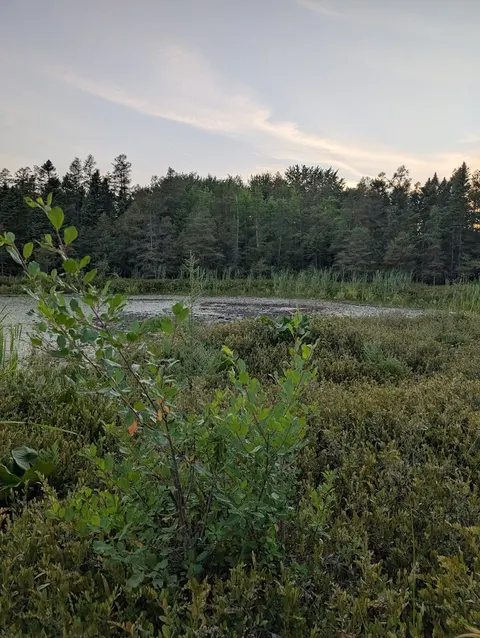
The Coves is west of Wharncliffe Road between the river and Baseline Road West. Its 2024 UTRCA brochure describes almost five kilometres of managed trails on gently sloping terrain. The ponds are remnants of an old Thames River channel.
The northern trails connect through Greenway Park to the Thames Valley Trail and Thames Valley Parkway. Use the brochure’s access-point map to choose the correct side of the ponds. Public trail links do not grant access across neighbouring private land.
Natural area opening hours, dogs and bicycles
Managed ESA access is listed from 6 a.m. to 10 p.m. Stay on marked trails and use official access points. Keep pets leashed, with a maximum leash length of two metres. Do not remove plants, feed wildlife or leave litter.
Bicycles are allowed only on permitted multi-use paths. The City specifically identifies asphalt or crushed-gravel exceptions in Kilally Meadows and Medway Valley Heritage Forest. A dirt walking trail is not automatically a bicycle route. Follow signs for the exact path.
Sources: City natural area access and trail rules · UTRCA managed natural areas, maps and issue reporting
Route and accessibility planning checklist
- Choose a public entrance and a route length that includes the return trip.
- Read the map legend for stairs, boardwalks, bridges, surfaces and parking.
- Check current construction, closure and river-condition notices.
- Confirm the needed surface, slope, rest points and washroom arrangements for your group.
- Use the actual signed trail rather than an informal shortcut shown by another user.
- City Thames Valley Parkway maps and construction
- UTRCA managed natural areas, maps and issue reporting
- Full parks and open spaces directory
The City inventory’s paved-path total is an infrastructure measurement, not an access audit or a guaranteed continuous accessible route.
Sources: UTRCA managed natural areas, maps and issue reporting · City parks inventory · City Thames Valley Parkway maps and construction
Reporting trail damage or maintenance concerns
UTRCA accepts management questions at 519-451-2800. Its ESA directory links a location-based reporting tool for damaged signs, boardwalks, bridges, stairs, fallen hazard trees and dumped waste.
Include the area name, nearest mapped entrance, exact trail location and a description. Use the City’s Service London route for ordinary park maintenance. A missing path length in open data is a different issue from an unsafe structure on the ground.
Sources: UTRCA managed natural areas, maps and issue reporting
Nature trail questions
Are all 21 London ESAs public walking parks?
No. ESA designations include public and private land. Use the managed visitor maps and official entrances rather than assuming access everywhere.
Is the entire Sifton Bog trail network accessible?
UTRCA specifically describes the 370-metre Oxford Street boardwalk to Redmond’s Pond as accessible. That statement is not an access rating for every trail.
Why does this guide list 12 managed ESAs when London has 21?
The figures describe different scopes. London has 21 designated Environmentally Significant Areas, while UTRCA manages 12 for the City. Some designated land is private. Use the managed-area visitor maps for public trail access.
Source: UTRCA managed natural areas, maps and issue reporting
Which Sifton Bog route is described as accessible?
UTRCA’s brochure identifies the boardwalk from the Oxford Street parking area to the Redmond’s Pond viewing platform as accessible. This does not describe every trail in the area. Confirm current boardwalk conditions before relying on that route.
Is Kains Woods a level paved walking route?
No. UTRCA’s brochure describes steep and muddy sections in its managed trail network. Use its access-point map and choose a return plan that fits your needs. The network length is not the length of every possible walk.
How do I choose the right entrance for The Coves?
Use UTRCA’s access-point map to choose the side of the ponds and trail section you want. Northern links reach Greenway Park and the parkway network. Public trail links do not permit crossing neighbouring private land.
How long can my dog’s leash be on a London ESA trail?
The listed maximum is two metres. Keep the dog leashed, stay on marked trails and follow site signs. An ESA is not an off-leash area, even where the trail appears quiet.
Can I cycle on every path in an Environmentally Significant Area?
No. Bicycles are allowed only on permitted routes. Use the official map and site signs rather than treating every visible trail as a cycling route. Natural-area trails and the paved parkway have different rules.
Who do I tell about a broken ESA boardwalk or fallen hazard tree?
Use UTRCA’s location-based reporting tool for its managed London ESAs or contact its management team. Give the area name, nearest mapped entrance and exact issue location. Ordinary City park maintenance uses Service London.
Source: UTRCA managed natural areas, maps and issue reporting
Can I use the total trail length as the distance for my walk?
No. A network can include several branches and connections. Choose your own start, route and return point on the current map, then check closures. The total network figure does not describe every loop or out-and-back trip.